

Mullerthal
Ideal: Ideal for hiking, photography, the outdoors, and an escape outside the city.
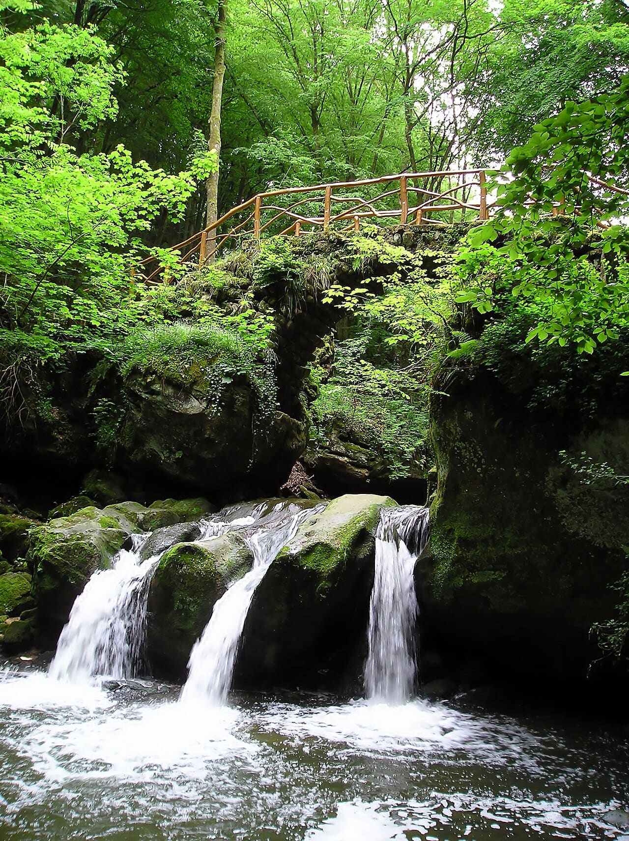
The region is called Little Switzerland not for its mountains but for its rocks: Luxembourg sandstone deposited about 180 million years ago cracked and eroded over time into narrow clefts, tunnels, and stepped passages barely wider than a person. The Mullerthal Trail totals 112 kilometers and is divided into several loops. The most photographed spot is the small stone bridge crossing the three-pronged Schiessentümpel waterfall. Because the ground is damp and mossy, shoes with good grip make a real difference.
Did you know?
Why is the region called Little Switzerland?
Because sandstone cliffs, narrow crevices, waterfalls and dense forest come together here. It is not mountainous, but the rock formations create a similarly wild texture.
How did the rocks form?
Sandstone laid down in the Jurassic some 200 million years ago was split by water and erosion into deep fissures. Some passages are narrow enough for only one person sideways.
How long is the hiking trail?
The main Mullerthal Trail has three loops totalling 112 km. It carries Europe's Leading Quality Trails certification and can be broken into day-length sections.
Why go?
- To see one of Luxembourg's most impressive hiking regions
- To walk among rocky paths, forests, and small waterfalls
- To add nature and movement to a city trip
Travel tip
Choose routes by difficulty level; some walks look short but rocky terrain can be tiring.